Monday 25 November 2013

A CITY BUILT ON SALT

Entrada Sandstone Fins at Fiery Furnace, Arches National Park. Salt made it happen!

Moab was an ancient kingdom situated along the East shore of the Dead Sea, a lake of salty brine in Palestine. But it is not the subject of this post. We are dealing here with a more recently founded place, settled by Mormons at the outset, as so many other cities in the Four-corners region. It is the only city in Utah placed in the Colorado valley. What has this latter-day Moab, a tourist center, got to do with salt, you may well ask?

In fact, salt lies at the bottom of Moab's whole existence, in many respects. You may be surprised to hear that the town is situated in the middle of a piece of real estate, with a a radius of some 150 kilometers, which harbors one of the biggest deposits of mineral salt in the world. Covered by sandstone, there lies resting, some 150 meters below the surface, a layer of that crystalline medium almost TWO KILOMETERS thick. This is the Paradox Basin we are talking about here, stretching South almost to the border with New Mexico, and encompassing both Arches and Canyonlands National Parks.

A salt layer of such enormity has some peculiar geologic properties, which were discovered by the experts only recently. You will find no mentioning of salt in early brochures of the National Park Service (Yes, I am still safeguarding the booklets we received upon our visits more than 30 years ago), whereas the modern brochures all take care to explain the role salt has played in shaping the environment hereabouts.

Moab Valley. Created by salt!
Over the eons, the Earth crust is subjected to a lot of pressures, as tectonic plates shift, collide and are shoved underneath each other. This has affected the gigantic layer of salt mightily. Salt is of a consistency in between rock and sirup, a geologic toothpaste so to speak. When horizontal pressure is applied to it, it tends to swell upwards, just like – well – the toothpaste in the tube you are squeezing in the morning, just at a greater, geologic scale.

Huge domes of salt have been created this way, hidden under their roof of sandstone. But the latter is not as plastic as salt, so when lifted up by the rising salt dome, it fractures into fissures. Eventually, the sandstone cupola (that can have a radius of several kilometers) breaks up into upward standing slates and would to us, flying above it, look a bit like enormous stones fitted into a valve or valved bridge.

As water starts siphoning through all those cracks between the vertical slates, the salt beneath starts dissolving and the bubble sinks back to itself. In many cases, this process comes to a halt, when the overlaying crust of sandstone gets back to its horizontal position. However, the cracks have remained and erosion continues. Eventually, the slates´sides will be shaved off and they start standing freely as so called Fins, as in the title picture. Over time, some of them are ground down completely and the remaining getting sanded down by the wind into sleeker and sleeker shapes. Holes start to appear in those fins and – Voilá! – an Arch is born. Delicate Arch is a good example of just one of many on the plateau.

Balanced Rock, Arches. La Sal mountains in background
But those arches don't hold forever either. As the hole under the arch gets bigger, the bridge above eventually collapses and only free standing hoodoos are left. Balanced Rock is a good example of this. Even those hoodoos are getting ground down over the year millions and the end result is a reasonably level plain of sandstone, when entropy has won the fight at long last. Look at the little stubble to the right of Balanced Rock. This is the fundament of a smaller balanced rock that fell down in the early 1970s. Precious little is left and soon what is left will have melted down to a heap of sand.

We said above that the salt bubble usually stops sinking back when the upper layer retains its roughly horizontal  position. But there are exceptions. If the original fissures are large and remain to feed the underlying salt with water even then, the dissolving continues and the sandstone layer eventually is hanging freely over a void. Of course, it collapses soon after and the result can sometimes be a huge valley, several kilometers long and up to one kilometer broad. These are the so called Salt Valleys. Moab Valley, which you can see above, is an example of such a construct.

When you journey to Moab for the first time, you may believe that the Valley has been shaped by the Colorado River, like so many canyons in the area. It is true that the Colorado runs through it. But it does so at an angle. The aerial view shown below demonstrates, how it has cut its way through the sandstone layer, coming from Colorado in the West and is now flowing into Moab Valley, which has been shaped by other forces. The valley is seen in green, with the town in the lower part of that green.

Aerial view of the Colorado entering Moab Valley       Source: Grand County, Utah
This takes care of our usual geologic outburst. Time to get back to the story we have to tell. You may recall that we had an intermission after Delicate Arch in the previous blog (God's Delicate Fingers). The last big iconic experience left to explore in Arches National Park is the fabulous landscape called Devil's Garden. In these surroundings we really can get our fill of Sandstone Fins, since the whole area is just built up by them.

Besides the fins, there are also numerous arches to admire, I count at least ten of them. However, as usual, we concentrate on the most scenic ones, Landscape Arch and Double O Arch. To see them both, you have to take a hike of some 5 hours (roundtrip), but it is worth it. So let's get on with it and tell about the trail's wonders as we go.

Devil's Garden Trailhead, Arches. La Sal mountains in the background
The trail starts in a cosy area, where Alice and I had been camping, back in 1980, so this is well treaded terrain for me. As you can see, visitors are being lured into the hike by a spacious path, which actually continues all the way up to Landscape Arch. But soon you come to a tight passage between cliffs glowing in intensive red in the shade. This is a foreboding of things to come, even if the terrain thereafter is widening again.

Sandstone Glow, Devil's Garden, Arches
But not to worry, the path is wide, the air is clear and the number of co-hikers is far from that on the way to Delicate Arch. This is a hike for aficionados, not for the creti and pleti among tourists!

Looking back at the "Narrows". Trail on upper right
It takes just about half an hour's walk to come to the main attraction of this hike, Landscape Arch. This wonder of slimness is said to be the longest natural bridge in the world. Looking at it, high above your head, and thinned out to almost nothing, you wonder how it can hold together at all. But hold together it does. In the old days, when I was young, I had climbed up there and treaded across – can you believe it? I have to say that it was kind of a balancing act in places, with the bridge not even granting you a meter of plane surface to cling to with your sandals.

Nowadays you are completely forbidden to repeat this act – not that I had thought of doing it again! You can't even go near the Arch anymore, not to speak of rambling under it to admire its span. There is now a only a fenced-in path at a distance, allowing you to inspect it without getting too close.

Fenced in Trail below Landscape Arch
How come that this most enticing bow of them all has been put completely off limits? There are ecological and safety reasons for it. There is a lot of sandy soil in the area; if left in peace, it is gradually gaining a fragile cover of vegetation, consisting of a very rare cohabitation of fungus, algae and lichen, found nowhere else in the world. Trampling the soil with your feet is destroying it for a hundred years. So better leave it alone!

The safety reason is less subtle: In 1991, a slab of rock the size of a large bus was falling of the Arch with a tremendous tremble and noise. The few lucky enough to see it reported that they feared the whole structure to come down. No one was hiking below or on the spider-thin bow just then, so no deadly accidents to report here, I am afraid. But it woke up the authorities and, ever since, access to the Arch is strictly forbidden. Will the Arch last throughout my lifetime? I doubt it. It really looks dangerously slim to me now; don't you agree?

Landscape Arch, Arches. The slimmest of the slim, but also the longest in the world
But we have still some challenges ahead of us, even if of smaller magnitude! When leaving the Arch, you start treading on uncharted terrain, so to speak. The National Park authorities characterize the continuing hike as "primitive trail"; in fact, there is no trail to speak of at all, just a few small stones lumped together here and there to show you where you are supposed to take a new direction.

The trail starts with a steep incline, where you have to climb one of the many Fins adorning the environment here. They are not as fine limbed as the ones you see in the title picture, more like whales with broad shoulders, but with VERY STEEP SIDES to climb and descend, which makes some awkward going forward now and then. The picture shows this first ascent. Fortunately it will dissuade any disabled old geezer to dare continue, even if I myself did not show any hesitance at that moment. The climb does not look very arduous from above, where I was standing, but the upward slope is actually rather pronounced. In the far back, you can see once again the "narrows" that started the whole exercise.

Arduous start of the "Primitive Trail"
After this first heart beater you arrive at a plateau where the view is wide and the "whale fins" spaciously laid out. The trail (as far as you can discern it) meanders its way alongside the fins and sometimes crosses over them. I have said it already, but let me re-emphasize that their flanks looked easy enough to access, seen from a distance, but arduous enough once you got close and had to do the real climbing or descending. Still, there were huge rewards awaiting you, once on top. The view was exhilarating from up there. I think the picture here exemplifies both the exhilarating views and the troubles of getting up or down the fins.

On top of a "whale fin". Tavaputs Plateau on the horizon
I chose this picture deliberately, among many fine ones taken on the fins, since it shows where Arches National Park (as well as the Paradox Basin) reaches its end towards the North. Let your eyes, after lingering on and admiring the multitude of red colored fins, sweep like an eagle towards the far horizon. There reign the ponderous cliffs of a plateau which is already known to you. Naught else but the high plateau of the Tavaputs do we rediscover here, known to us since the post Devil's Due.

I have to admit that I fell in love with the fins and the marvelous views they had to offer. Luckily, a fellow traveller was kind enough to take my picture, when I was standing on my absolute favorite, with red cumuli all around me and the La Sal mountains glistening in the background against an azure sky.

Emil Ems on Sandstone Fin in Devil's Garden, Arches. La Sal mountains in background
I had to almost tear myself away from climbing up and down those "whales". It was getting afternoon and time to come to the final goal of the hike, the Double O Arch. This is a funny name and you only get to grips with it when you have seen the object in question. It is a wondrous construct of red stone, fashioned a bit like an antique Greek "Lyra", at least if seen from the backside. It looks not quite as imposing when you approach it on the trail. You simply stand to close to it to appreciate it in its all embracing stature. Here is a picture of it, with the Group of Eight just arriving at the right spot.

Approaching Double O Arch, Arches      Courtesy Lars Ljungberg    
You say that I am in the picture, laboring after my hiking companions? You are perfectly right! I did this hike TWICE, once within the Group of Eight, but without camera, and once alone with the camera. Lars Ljungberg from the group was so kind as to lend me one of his pictures from the first hike, which I find marvelous.

Now to the somewhat embarrassing part of the story. It is difficult to see on the picture, but underneath the lower "O" of the Arch is a vertical ledge, almost two meters high, which you have to climb in order to pass over to the Arch's other side; only there will you enjoy its magnificent fullness.

I did not bother to climb that ledge on the first hike; what is the use of a magnificent vista, if you cannot catch it on film? But I forgot my limitations as climber! On the second hike, when I went alone, I simply could not find ways and means of climbing that damn ledge. It proved simply too much for me! I waited under it for at least half an hour, hoping for a strong youngster to come along and give me a shove. But nobody came! At long last, I was forced to admit defeat and take the long hike back. To show you what I have missed, National Park Services have come to rescue. They have a huge stock of pictures from their parks on Internet, all of them excellent, and I am really grateful to be able to show this one:

Double O Arch, Arches          Courtesy National Park Services
What else is there to tell from this exhilarating hike? Well, there were many nice views again on the way back, especially since it was getting on in the afternoon and "light was getting right" for a true photographer. But let's make a long story short and just illustrate this with a last picture from Devil's Garden. We are back on the broad and well prepared path that started at Landscape Arch and will soon arrive back at the Trail Head.

Devil's Garden, Arches. Path back to Trailhead
You can imagine that I was a bit tired when I regained the rented car at the Parking Lot. Still, this did not prevent me from stopping the car many a time on the trip back through the Park. The sun was slanting towards the horizon at a leisurely rate, permitting me to take in many more vistas of this marvelous plateau, created by salt. So let's end this post not with words, but with pictures, saying "Goodbye!", through them, to a place of sheer beauty that I won't see again in my lifetime!


Cotton Wood on Courthouse Wash in late afternoon, Arches

The Organ, Arches

The Courthouse Towers, Arches

Friday 22 November 2013

GOD'S DELICATE FINGERS

A Divine Vision?

In early August 1980, my wife Alice and I were driving across wide sagebrush plains and river canyons from Bryce Canyon Eastward all the way to the Colorado River valley.

Towards late afternoon, a thunderstorm was developing over the plains and lasted until our arrival in Moab (the gateway to Arches National Park). Since it was raining heavily, we decided to take in at a motel in down (the Apache Motel), instead of camping in the Park, as originally foreseen.

We were both tired from the long trip along curvy and sometimes unpaved side roads. Still, the rain abated towards evening and I got my spirits back soon enough. So, on the spur of the moment, I jumped into the car and rushed over to Arches National Park, my wife being quite content with resting on her bed. How lucky I was to have taken this decision. I was all alone on the Park's high ranges. Clouds were still hanging heavily over the red wonders of that park, but here and there the sun broke through and painted the rocks like a spotlight.

Suddenly, I just HAD to put on the breaks and hasten out of the car. It was like a vision had materialized before my eyes. "This surely must be God's fingers, showing me the way to Promised Land!", I almost convinced myself. But after a quick "Clicketyclick" by the camera I was sobering up soon enough and regaining my agnostic view of the world.

Arches view in 2013
Still, this experience, and the picture I had taken at that moment and cherished since then, kept my interest in the Four-courner region alive through all these years, and greatly contributed to my decision to dare fate and undertake the present trip to Utah despite my advanced age.

Between us "connoisseurs" of the slick rock country, Arches National Park is commonly held to be the most beautiful to behold, with a manifold of interesting and intriguing stone formations. I would not like to spoil this post with geologic explanations. Let's leave those to the chapter that will follow soon enough. Why not focus today on the iconic wonders of that red wonderland. After all, nature has worked hard at creating them, over the eons, by letting the land rise and thereafter being eroded by the joint forces of wind, ice and water.

Even if you were to spend a year in the park, rambling all over the place, you would never cease to discover new formations to tickle your aesthetic senses. But space is limited even here on internet, so let's just get to a few examples: Balanced Rock; The Window Section with Double Arch; Delicate Arch; and Devil's Playground (with Landscape and Double-O Arch). We will look at them in the order in which they were visited by me, driving a rented car, whilst the rest of the Group of Eight were enjoying a challenging river boating trip).

"Park Avenue", Arches       Courtesy National Park Service
The entrance to Arches National Park is just five minutes' drive away from the town of Moab. Once inside, you take a winding road upwards a steep rampart of fiery red stone until you arrive at a high plateau with views as wide as the eye can focus. You feel transported to a different planet, profusely red as if given light by a dying sun. Driving there feels like journeying on the Mars of our imagination, back when we were reading with eager young eyes about adventures of superhuman heroes on that reddest of planets, composed by our most creative writers.

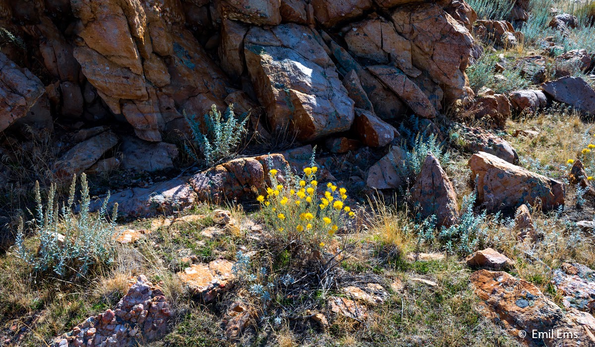
But let's not get carried away. We are still on Earth, even if on one of its places of utmost and outer-worldly beauty. This high plateau is delightful to behold for us tourists sweeping along on paved roads, but we should not forget that it is mostly a barren desert, with only scant access to water. Granted there are a few washes that save water from sparse raining and provide sustenance for lovely cottonwood; but overall, this is sagebrush country, which leaves the beautiful colors of earth and stone uncovered and observable to our admiring eyes.

Cottonwoods at Courthouse Wash, Arches
Now on to our iconic views: the first you see – after driving along the road glanced in the above picture, and rounding that promontory in the far distance – is Balanced Rock. This impressive Hoodoo is among the most photographed features of National Parks of all times. One reason being, of course, that it does not take many steps from the car to approach and circumvent it.

It is difficult for me to provide you with an original view of this balancing act, it has been portraited from all possible angles and at all possible seasons and hours of the day. But just to show you that I have been there and taken the short hike all around this monument, here are two pictures taken at opposite angles.

Balanced Rock, Arches
How to judge the scale of this monument, lacking some human sized objects to compare with? We should not under-estimate the rock's stature. Its boulder, balancing on top of the column, is of the size of THREE SCHOOLBUSES. The whole structure looks considerably more portly nowadays than it did back in 1980. Apparently, the top is gradually grinding down its support, without toppling over however. Nature's most balanced road towards entropy, if there ever was one!

To illustrate how difficult it is to maintain that balance, there was a much smaller balancing rock standing just aside the big one, but that one toppled down in 1976, despite the fact that it didn't weigh more than maybe a tenth of the larger. It was called "Chip of the Old Block"; to our regret, we never had a chance to admire it.

Now on to the next wonder view in Arches, the Double Arch. This most impressive of all stone structures in the Park lies in a section called Windows. Actually, there are at least five arches in that part of the Park, along with other interesting structures, but no need for arches overload in this short post. Let's just stay with this the most imposing one. The more so since it figured in a famous movie with Harrison Ford (in a scene where his younger self is played by River Phoenix), called Indiana Jones: The Last Cruisade. There is a small video showing young River on site, but it is not very spectacular. But if you are curious, why not have a go at the video, scrolling 32 seconds into the action?

Double Arch, Arches
You can reach this arch by taking just a few steps from the car, but it is impressive enough even from there. For the more enterprising of us (me too, 33 years ago), there is always the possibility of climbing up and through the structure, a far more advanced hike. You are not impressed by the size of this cathedral-sized monument from the above picture? Not to worry, I risked my life climbing up there halfways, in order to clarify to you its impressiveness;-)

Double Arch, Upper Bows, Arches
So there: impressive enough, isn't it? It does not quite reach the height of the Cathedral Dome in Florence, but still comes close to 2/3 of that Dome's rise above the Cathedral.

But size is not all, any aestheticist can tell you that. Furthermore, the Park is giving you the choice between impressive and delicate/beautiful. This leads us to the last monument to investigate in this post, the Delicate Arch.

This beautifully crafted act of nature is not as easily accessible as the earlier monuments, but this is to its advantage. The more effort you have to spend to experience beauty, the more you appreciate it of course. In the present age of Internet, we are only too spoiled by having effortless access to pictures of all places on Earth with a click of our pinkie. But a picture on the screen is nothing compared to the real thing, especially if you have to take an arduous hike to experience it.

The path towards Delicate Arch is starting out pleasantly enough. You pass by an ancient cottage, more than 110 years old, which gives you a good impression of life as small farmer in the Southwest in those days. It was built by John Wolfe, a civil war veteran who moved out here in 1898, at age 69 – almost my age, imagine! – and established his ranch in those barren fields.

Wolfe Cabin, Arches
The cottage was built out of cottonwood logs, that he had to move here from Cottonwood Wash no doubt (se earlier picture), which lies at a distance of about 10 kilometers from his ranch. Where did the water necessary for him and his cattle come from? Actually, there is a wash just five minutes from the cottage – called Salt Wash, I believe –, but it did not seem to have drinkable water in it when I took the picture below. But maybe he had a barrel that he filled from the wash immediately, whenever it rained, to have clean drinking water for himself and his family. Furthermore, he had built a primitive earth dam across the wash, which certainly kept more water in there than I saw. The dam is long gone, of course.

Salt Wash behind Wolfe Cottage, Arches
After this brief interlude, it iwas mainly a question of laborious trudging uphill, for an hour or so, depending on your stamina. You first have to climb a steep cliff on a serpentine path, but this path is well maintained. Thereafter, you soon come to a large slate of pure slick rock, slanting rashly uphill, and taking your breath away for a kilometer or so. You can see the beginning of this large slate in the far distance on the picture here.

The laborious path to Delicate Arch, Arches
You don't think that this looks very arduous? Well, if you take a picture with your camera slanting upwards, the slope appears mightily diminished. Let's give it another try to show you what you are climbing there: pure slick rock angling sharply upwards and doing this at great length.

Entrada Sandstone slick rock on the path to Delicate Arch, Arches
You may be surprised by the number of people who marched alongside myself on that path. But you would be even more surprised, had you seen the marked number of grey haired veterans, older than even myself, some of them almost creeping uphill on crutches, all striving to reach the ultimate in aesthetics. For many of them, this uphill struggle must have likened a pilgrimage to a holy place, so intent were they to keep going, whatever the price in sweat, tears, torn limbs or heart ache. Was it worth it, you may ask? Well, let me continue the story and you will soon get the answer.

After this steep incline, it is only a question of navigating a narrow path of some 100 meters, hoed into a cliff with an almost vertical facade. Now we come to the interesting part of our story. Back in 1980, I had of course no difficulties in ascending this path. Clad in sandals, I was almost running uphill, having left my wife Alice in the camping ground, since she did not feel like hiking that day.  Once arrived at the narrow path hoed into the cliff, I started to relax, feeling that the goal was close.

As an aside, you can see me, in the picture below, laboring behind my colleagues from the Group of Eight on that same path three weeks ago. But didn't I say before that I was in Arches on my own, with a rented car? Sure enough, but I took this hike TWICE, once within the Group of Eight, but without a camera, and, the day after, on my own, and WITH the camera.

But back to 1980: As I was ambling along that path, just some 10 meters back of where the picture above puts me, I suddenly seemed to notice a bit of sky and the odd ray of light shining through the cliff above me. Still young and curious then, I felt the urge to investigate. But how to get up to that opening in the cliff, however small it might be?

Delicate Arch ahead, just around the corner       Courtesy Gert-Inge Persson     
Fortunately, at that section of the path, the wall had a mild backward slant, starting about 1.5 meters above the path, and it seemed plausible that I could climb up from there. But how to get up the first vertical section? Well – remember that I had sandals at my feet then – I went backwards as many steps as the path permitted and, starting from there, RAN UP this vertical section with schwung, just barely getting hold of the stones above it. From then on, it was quite easy to continue the climb.

And what did I see up there? A huge window in the wall, with the most wondrous vista of the valley beyond. At the far distance, huge mountains beckoned in light blue, dominating the horizon. In the medium distance, a large cliff divided up the plain into two great scenes, as made for performing an imposing theater play. And, now comes the clue, to the very left of the foreground scene an object of sheer beauty was grasping my attention. A bow of glowing red – as if Hepahistos himself had forged it as a wedding ring for Aphrodite, his betrothed – was standing, delicately poised, on an amphitheater formed of bold orange sandstone.

With this glorious memory still lodging firmly in my brain, I felt the strong urge to get up there again this year, as soon as passing by the very same spot on the path. But, to my great regret and however I tried, it appeared simply impossible to heave myself up over the first vertical section. This is what it means to get old; your options dwindle as you approach the inevitable end.

Should I give up? Not so fast! Along came a youngster, much bigger and muscular than myself, even in younger years, and I hastened to ask him to give me a heave. And heave he did, almost throwing me up the cliff, with my 90 kilos and all! Thanks to him I was able to freshen up a dear memory and, furthermore, document this fabulous scene with all the verve that modern equipment can provide.

Delicate Arch seen through window in 2013, Arches
Didn't I have the good sense of documenting the view from that window already back in 1980? Sure I did and I had good reason to do so. For back in those days I had never read or heard about this special view before. And neither did I see it mentioned in any publications that I studied afterwards. I may well have been among the first Park visitors ever having climbed up there and seen this marvelous scenery. I felt like a mighty explorer, when documenting this view for posterity! Here is the picture I took in 1980:

Delicate Arch seen through window in 1980, Arches
Of course this is a well known – and photographed – view of Delicate Arch nowadays. There is no way this type of view could have remained undiscovered in our times of Internet, where people are eager to share their experiences with pictures. As soon as one person has put a picture into the Cloud, thousands will follow.

Should I show you a close-up version of the Delicate Arch, to really emphasize it in all its glory? I would feel uncomfortable doing so; for each picture I have taken, I can easily recall at least ten others, taken from the same position and time of day by far greater photographers, which outperform my own humble efforts. What I will do, instead, is show you the first picture ever made of this Arch. It was taken by the daughter of John Wolfe, of all persons. She had moved to her father's farm in 1906 and he spared no effort to make her feel comfortable in the desert, including buying her a camera to document it all; imagine!

First picture of Delicate Arch, taken in 1907     Photographer: Flora Stanley
You may notice that, already in those days, people longed to have their picture taken standing close to, or even under the Arch. We may presume that the two persons here are Flora Stanley's husband and brother. I don't believe her father would, at the age of 78, have bothered to take the walk up to Delicate Arch just to be portrayed under it.

Interestingly enough, when I was hiking up there in early August 1980, I did not meet or see a soul. I was all alone in this enticing landscape. If you look closely at the two views from the window, you will discover plenty of people in the Arch's vicinity in the 2013 picture. In the 1980 version, there are none! And neither were there many in the Park at large in those days! And most of those never ventured far from their cars. It appears, that people have discovered America's national parks since then and started to love them with abandon!

Let me just emphasize this point by taking a closer look at the Arch after all. When I took this picture, I was in good company. I could count more than a hundred people lingering around that arc, about half of them standing in line to have their picture taken standing smash under it.

Picture taking session under Delicate Arch, Arches
But I shouldn't complain. Am I not myself one of those eager beavers, going wherever I am still able to go, and taking pictures of the icons of our day? Thinking those thoughts, whilst ambling around in that mellow amphitheater, I was, to my great surprise, constantly addressed by small groups of young and enticing girls, that absolutely wanted me to stand in their midst whilst they had their picture taken. This was kind of puzzling, since I really cannot see myself as very attractive to the youngest of the fairer sex. But maybe there is some superior wisdom residing in those fresh brains. Does not every object of beauty need a counterpoint, to emphasize its merits? Seen in that way, I probably did a lot of emphasizing that day, to the pleasure of many youngsters, as well as to mine.

With this encouraging thought, I think we should call it a day and deal with remaining Arches issues in the following blog post.


Saturday 16 November 2013

DEVIL'S DUE?

Soaking in Diamond Fork Hot Springs
Our Group of Eight had walked already for one hour and a half when, suddenly, a sharp smell of sulphur permeated the air above the creek we were exploring. Was this a sudden warning from the underworld, telling us that "Hin Håle" was on his way, trying to inveigle us into sinning? We would soon find out. Around the next bend of the path, a serious of small water basins, colored in various shades of azure and green, welcomed us, and it was as if a voice whispered to us: forget about the travails of this world, isn't it time for you to start enjoying yourself?

It was easy to let us be seduced by this inner voice. Soon all of us, but me – I had to take the picture, did I not? –, succumbed to the temptation to soak their tired feet in water alternately hot or warm, depending on the exact position of their soaking.

Just three hours before, we had left our hotel in Ogden and started the car trip South to reach our hunting grounds for the next couple of days around Moab. Our guide Ingemar found it opportune to take a nice mid-day break, so that the voyage would not be felt too long. After all, we would be spending more than five hours on the trip.

As many other places in the US, the mountain region around and south of Salt Lake City is still not quite settled, geologically speaking. Even if volcanoes are long gone and only strata of old lava can be observed here and there, the movement of the tectonic plates has left faults, fractions and fissures, where the magma sphere from deep down can influence the upper strata.

The Wasatch Fault        Source:   
The Wasatch Mountain Range, along which most of Utah's inhabitants are living, is still very active in this regard. Along the whole range, especially below Salt Lake City, there is a deep fault, called Wasatch Fault, with an earthquake risk at par with that of the San Andreas Fault of the East Bay. This means that a quake of size 7 or larger is expected to occur every 300 years, and should occur according to this assessment any time now. We are talking here about a quake of a size that destroyed San Francisco way back in 1908! And the latter affected a town built on solid rock, whereas Salt Lake City is placed on a quivering former lake bottom, which will greatly reinforce any vibrations caused by a quake. Imagine!

Of course, hot springs, having their origin in a spiderweb of minor cracks and fissures of the Earthen crust, are essentially harmless and pleasurable. They occur here mostly in a region, called Uintah, with a mountain range extending perpendicularly to the East from the Wasatch Range at about the latitude of the town Provo. There, water is percolating down the cracks and fissures, meeting rising magma halfway down in the Earth crust. Mightily heated by the meeting, the water, enriched by minerals, rushes up back to the surface and appears as a series of hot springs adorning the region.

Boulder Conglomerate along former sea shore – Diamond Fork Hot Springs Trail Head
A two hours' drive had brought us all the way down to South of Provo, where Utah State road 6 branches off from Interstate 15. Looking forward to a pleasurable hike, we we took a small byroad into the Uinta foothills, up Spanish Fork Canyon, until we arrived at a quiet parking lot indicating the trailhead for our hike.

Soon we were on our way, crossing a bridge where the Sixth Water Creek was joining the Fifth Water Creek (Don't they have any imagination for naming in Utah?). From then on it was just a question of climbing a ravine steadily uphill, with the Fifth gurgling contentedly below our feet.

Bridge at Fifth and Sixth Water Creek junction
I have to admit to a certain anxiety whilst treading the path. Did I not see enormous boulders balancing precariously on the crevasses just above our heads? And did we not stumble over, or had to find a way around, substantial boulders that had already fallen and were blocking our path? If for no other reason, this warranted a rather hurried pace in our uphill progress.

Interestingly, those huge boulders did not consist of solid, contiguous stone. Rather, they looked like a collection of minor boulders, some of them as big as my head, cemented together as if a giant had formed meatballs with his paws out of stone junks, instead of junky pieces of meat. Unfortunately, I do not have a close-up to demonstrate this, but you can get the idea by looking at the earlier picture of the trail head, with what looks like a giant termite roost, in which the smaller boulders are also embedded and clearly visible.

How to explain such geologic abnormity? Well, the region must once, millions of years ago, have been a shoreline, on which stormy waves deposited boulder after boulder and, furthermore, hollowed out the cliffs forming the shore and loosening the boulders embedded therein. Eventually, sand and lime bonded, like concrete, those stones together and preserved the structures over year millions, for us to admire and puzzle out their provenance. This type of stone structure is called Boulder Conglomerate and it exists, in the Uinta Region, in a geologic stratum called North Horn Formation.

But enough of those geologic details. There is a hike to report on! As said in the introduction, it took us only one hour and a half to arrive at the goal for our promenade, the Diamond Fork Hot Springs. We had nursed the hope of being the first visitors of the day, since the nicest part of this area is the lower basins, where some kind forerunners had in the past fabricated crudely made but eminently usable basins to soak in. But, we weren't so lucky, this is a popular hiking spot, and those basins were already occupied by a relaxed family.

Lower section of Diamond Fork Hot Springs
We had better luck with the upper section. This is a much wilder, but as enticing part of the compound. A waterfall is feeding the springs from up high and has over the ages formed some natural basins you can wade into with some effort. But once in, they are as comfortable to use as any old bath tub.

I think the title picture says it all; a happy-go-lucky group of contended travelers, enjoying the pleasures provided by nature! But what about the waterfall you say? Can't you show us any pictures of it? Well, your wish is my command!

Diamond Fork Hot Springs Waterfall
As you can see in the picture, this is not only a waterfall of water, so to speak, but also one of stone. The latter is of a material called Calcareous Tufa and has been deposited over the ages by the mineral-rich water, as it gushes down the crevice. Interestingly, water has interacted with stone and bored a hole in the latter. In spring, when water aplenty is rushing down the creek, it will come streaming through the hole as well as over it, providing an intricate view of this convoluted structure.

When seeing it, I immediately felt the urge to climb up there and exhibit myself glancing through the hole. But caution got the better of me, thinking about the slickness of wet stone and the risk of falling off the cliff. But the rashest among our group showed no such concerns and did the deed I only dared dream about. Here you can see him returning, his task accomplished!

What else is there to tell from this hike? At our return, the sun's angle had changed and a section of the path, hitherto in shadow, was now illuminated beautifully, shining in bright red that induced some "Ohh!"s and "Ahh!"s from the group. Little did we know that this would be only the first of numerous such views, to be experienced down South on our continued journey. Soon, such admiring sounds would be sounding ridiculous in view of a region that was completely clothed in stones shining in various shades of red.

Red sandstone along Fifth Water Creek
The hike down went of course a lot faster than the uphill labour and after less than an hour we were back at the trail head, as can be seen in the picture below.

Back at  Diamond Fork Hot Springs Trail Head
Tired but satisfied, we relaxed in our small bus and let the guide drive us out of the Uintah ranges. However, shortly before we returned to State Road 6, we shouted to the driver to stop the car. In the distance, we were glancing at a classic Western scene: a herd of cows being driven by Cowboys! So out we rushed from the vehicle to document this iconic view. The two riders, being quite amiable, humored us by putting up a show, driving the cows along with verve. One of them was especially vigorous, swinging his lasso with abandon. To honor him, I have put him into the picture twice, and it makes it a nice composition that way, don't you agree?

Cowboys driving herd in Spanish Ford Canyon
This essentially concludes the report of that day's hike. But let me ramble on a bit more, since – as you probably have realised by now – I love to extemporise on landscape features prevalent in this outer-worldly land of the Saints.

As we continued our drive South on Utah Road 6 we were still, at the outset, traveling in mountain terrain, a bit similar to Austria's middle ranges. But soon we drove over the last passes and began a several hours' long descent, after having left the two coal mining towns of Halpern and Price behind us. And now I have to call myself lucky for having been granted the luxury of sitting as passenger beside the driver.

Before my eyes wide open, a seemingly limitless scenery spread its wings. The road went on without the slightest curve apparent for miles and miles (and I am using Swedish miles here!), until it converged to a tiny line in the far distance. The land slanted slightly downhill, almost unnoticeable, but the car had no difficulties ambling along. In the far distance you could just barely glance a dark band of a wall, covering all of the horizon, from far left to far right. as if circumcising a city of unlimited size. To my left and right, a steppe reached as far again as the eye could see. All in all, this was Big Sky Country if I ever saw one. And you did not even have to go to Montana to experience it.

As we drove on, and after an hour or so, I could begin to see contours in the far wall and started to understand that I must be experiencing the grandmother of all table lands. And how right I was; this was one of the larger plateau lands existing in the US and I had the supreme luck of seeing it spread out right before my eyes! We are talking her of the TAVAPUTS PLATEAU (it deserves to be written in capitals). This remarkable table land has an escarpment (the wall I was perceiving earlier) that runs unbroken for some 170 kilometers and is at places more than 1 kilometer high. The land on the table is one of the last unbroken wildernesses of continental US (not counting Alaska). There are no paved roads through it, warranting relative calm for the rich wildlife roaming on the top. Only 20 years ago, the completely roadless area comprised some 10 000 square kilometers! Unfortunately, mineral exploitation has brought that area down by half since then, and this development will not stop in future!

The immense escarpment of an immense tableland
This remarkable landscape was completely unknown to me before seeing its escarpment appear before my very eyes; the details provided above I found out just now, doing research for the blog post. Neither do I believe the average American to ever have heard of it. Still, the Green River cuts right through it and forms a canyon, quite as deep and large as the Grand Canyon in Arizona. But how many people have ever taken note of this, not to speak of having visited the canyon?  Its first explorer called it Desolation Canyon for a reason! Its remoteness used to be its shield, since it kept most people away from it, protecting flora and fauna all over the plateau. But nowadays it is a disadvantage, since mining companies can feel free and unobserved whilst projecting for the rich deposits of mineral, gas and oil to be found in the region.

Large as it is, the Tavaputs is only the first of several plateaus that we would experience in the following days. But it was an impressive beacon for me, or road sign if you would prefer, to make me aware that we had entered the fabulous fairyland of the Colorado Plateau. This region, as large again as the Great Basin, consists of a multitude of many-colored tablelands, like Tavaputs (even if the latter is mostly grey in color). About one third of it is placed in Utah; the remainder of our hikes would lead us to many exciting places therein!

The Utah Part of the Colorado Plateau – Tavaputs on upper right


Wednesday 13 November 2013

ISLE IN BRINE

Buffalo Statue, outside Visitor Center of Antelope Island
We are standing here just outside the Visitor Center of a "barren" island in the Great Salt Lake. By "We" I mean our little hiking group of 8, which just the day before, on October 18, had arrived in Salt Lake City, Utah, after an arduous 15-hour trip from Stockholm.

The Island, called Antelope Island, lies South of Ogden, the former great center of the Pacific Railroad. It is connected to the broad stretch of land extending below the Wasatch Range by a road bank, which can be glanced in the picture. As the road approaches the lake from the Northeast, the land turns gradually into marches and mud flats, until the mud turns into the salty lake water.

Why the buffalo on an island that appears to be burned and dry, embedded as it is in salty water? In fact, the island is rather fecund, but we did not see this in October, when most of the flowers had finished blooming and the grass dried out. We are standing at an altitude of some 1200 meters, with the island tops rising up to 2000. It rains regularly and there is snow in wintertime. There are many springs and even wetlands, warranting a rich bird life as well as roaming areas for more substantial critters.

Lonely Buffalo near Bridger Bay
This brings us to the buffalo: the island, as a state park, happens to harbor the greatest herd of buffaloes in the world. This does not say much, since this wild oxen is almost extinct, but we should be glad for what little remains. We had high hopes of locating a substantive collection of these beasts, dreaming of stimulating them into a stampede, for photographic purposes only, of course ;-) But it turned out that they chose the Southern part of the island for grazing that very day, so only one or two outliers could be glanced along the driveway to our hiking loop.

But isn't the island called Antelope Island? What about those gracile mammals? "Yes, indeed!", you can find them here as well. They are called Pronghorn Antelopes. Unfortunately, they kept completely hidden from us that day, no doubt because there was a huge Running Event taking place on the island concurrent with our visit, so the wild ones wisely kept to the calmer areas in the South, away from the hooting, puffing and sweating crowd encroaching on their stamping grounds. But I should not exaggerate; the island is large and the crowd appeared quit thinned out in the great expanse.

Panorama, looking Northwest from White Rock Loop Trail
To emphasize this point, take a look at the Panorama. Please double-click on it to increase its size (I hope your screen is wide enough to get it all in!). To the left, you can see White Rock Bay and, behind it, Buffalo Peak. Far off on the upper right the Wasatch Range is beckoning, colored mauve due to the great distance. Now take a look at the plain, just below where the Wasatch Range begins to taper off towards the right. Here you see a collection of small black objects, fronted by a white flap. This was the start and finish of the Great Run and also the start for our hike, the latter taking about 14 kilometers. Even if that seems a lot, the panorama you are glancing at is representing only 1/10 of the island's area; and even if our hike along the so called White Rock Loop ranged southward from here, we barely saw 1/4 of the island. So a lot of room for the wild ones to hide in and avoid contact with us!

But back to the antelopes!  Even if I did not manage to get them into the camera this time, I was more lucky (that is, young enough to handle my camera with speed) in 1980. Back then, we were approaching the US Southwest from New Mexico, spending an afternoon and evening in the romantic area of Petrified Forest. In those days, if you were lucky, you could still have a whole National Park for yourself. It had rained heavily earlier that day and was just clearing up when we arrived, so we had a great time taking in the splendor of that monument. Suddenly, when turning around, I saw two animals rushing up a slope (to get away from us, no doubt!). Up with the camera and "Click!" with the finger, and the result is now here for you to behold:

Pronghorns in Petrified Forest National Park
Interestingly, those critters don't look like antelopes to me. With heavy body and spindly legs, they appear more like oversized goats, don't you agree? In fact, the Pronghorns are not related to antelopes at all, they form their own species, being the only surviving member of the antilocapridae family. And they feature proudly on top of the list of fast running species. They are the frontrunners in America (with a top speed of more than 100 km/hour) and the second best in the world (after the Gepards).

There is no lack of wild species on the island. Coyote is of course prevalent here, and mule deer and bighorn sheep can been found as well. Bobcats roam the nights, but you may never see one and, in any case, you may not wish to come too close. Lesser mammals like badger, porcupine and jackrabbit, as well as rodents such as ground squirrel may cross your path on the hiking tour.

Map of Great Basin        Source: Wikipedia
How come that there is a large island in the Salt Lake, with tops rising up to 1000 meters above the level of the lake, in the middle of a wide area that is essentially flat, covered by brine and salt planes? I am glad you ask, since the geology of the area west of the Wasatch Range, stretching across Utah and Nevada, is rather interesting. The area is called the Great Basin, essentially a sink, more than 2000 meters below the bordering mountain ranges, the Wasatch Range on the eastside and the Sierra Nevada – bordering California – on the westside. The denomination of "sink" is very appropriate, since all rivers running into the area lose themselves and eventually evaporate.

This enormous sink, of a size a bit larger than Sweden, is essentially a desolate desert, broken up by a series of north-south oriented mountain ranges – most of them arid and barren as well, except on high. Where mountains are absent, it stretches out essentially flat, with a salty crust covering the shallow valley bottoms. You may not wish for your car to break down, if venturing out far on one of the rare sidetracks to the main routes. Without mobile phone, you will face certain death as soon as your water is running out.

Into the Great Basin – north-south mountain range in the background
How was this great sink created? We have to thank the movement of the tectonic plates for it. Usually, those plates are grating into, or colliding with, each other. Wherever there is a collision, we can experience harsh mountain ranges, such as the Alps and the Himalaya Range. However, the great decline against the basin of the Rocky Mountain outlier (the Wasatch Range) here in Utah was actually formed by an opposite form of tectonic movements, and so were the great mountain inclines to the West of the sink.

Think of a giant rectangular wedding cake, placed on two tables put together so as to form a unified support. Now move those two tables slowly apart and watch what happens: eventually, the middle part of the cake will start to crumble and crinkle, sizable parts of it falling down in one piece, others clinging on a little while longer. Those later ones will also fall at a later stage and partly align on top of the earlier pieces. As you look at the lower support area, where all the pieces will have ultimately landed, there will be pieces of cake lying level with the support, interspersed with slanting pieces representing elevations above the support. The latter will mostly be aligned some 90 degrees against the disruptive movements. Remains of the cake will stay on top of each table, their ends rather abruptly broken off. Standing on the new lower level looking upwards, those brake-offs at the table ends will look like large mountain ranges to you, rising high above the smaller ranges placed on the lower support.

Wasatch Range, seen from Visitor Center
It took geologists a great many years to understand, how the Great Basin was created. The hypothesis crudely explained above emerged first after the War. But it seems very plausible to me. Very precise measurements  have shown, that the Eastern and Western fringes of the Basin continue to move away from each other at a pace of 2-3 cm per year. This is adding up over the year millions! What causes this movement? The most recent theory is that an earlier pacific ocean plate had been forced under the American continental plate and broken up underneath the latter plate approximately where the Great Basin is located. This meant that the Great Basin part of  the American Plate is located, without an intermediate shield, directly above Earth' superheated magma. As a result it is thinning out and expanding, not unlike a copper plate, being heated from underneath by a blow torch. Fascinating, isn't it?

But let's move on to more mundane things! After all, we have a hike to report about. As already said, our walk was some 14 kilometers long and ran along a loop in the North, called White Rock Loop Trail. The nice thing about this trail is that it is easy-going. No doubt, our travel guide used it as a warm-up for future challenges. But, even if the terrain is not very demanding, it has a lot of unusual features to show for it, as well as unexpected encounters. The latter did not involve wild animals to any degree, but rather the runners mentioned earlier, as well as the odd man or two on horseback. For riders, this island must be ideal, you can roam freely over hills and dales and feel like a true Westerner, pretending to be a buffalo hunter, like in olden days!

"Buffalo hunter" on White Rook Loop
Even if the trail essentially goes along hill flanks without really mounting any tops, there IS the possibility of doing so by a small deviation from the beaten tracks. The top in question you can climb is called Beacon Knob (the name says it all, no huge promontory there!). Even if not a great challenge to us mountain climbers, it offers an enticing view of the Lake, the valley beyond and, farther out, one of those North-South leaning mountains adorning the Basin.

Standing on Beacon Knob
I am well aware that some of the readers of this blog are experts in botany. To my regret, I have not a lot of flowers to show for it this time. The walking pace induced by our guide Ingemar (he is standing to the right on the above picture) did not generally permit me to take in and photograph flowers at my usual leisurely pace. But this is understandable; if you are with a group, there are deadlines to observe and group interests to take into account. Furthermore, since the other members were younger and more vigorous than me, there was rarely the option of making up for my leisurely hobby by running, once the deed was done, after a company of hikers rashly disappearing from view.

Not that there were many flowers to take in, after all. Due to the late season, there were mostly barren stalks adorning our route. But here and there, some of the lovely petals remained, usually yellow in color. Here is an example for you. I have to admit that I am not familiar with this special flower.

Last flower on barren stalk
Even so, there were places, behind shadowing cliff formations, where alpine type vegetation seemed to thrive. So let us finish this blog post on a positive note, observing that also in the cold and dry season, flora seems to thrive and survive, granted that it can find a suitable niche to do so.

Flowers and shrubs sheltered by rock